
Explanations and Remarks:
- The hike route is marked with colored circles on the map.
- The maps were created using the Swisstopo Maps .
- The profile was computed using Swisstopo and stored as an image.
- The ascent and descent values were computed from the profile. The values are hence greater than the difference between the lowest and highest elevation point.
- The
hiking time
was computed as the average of the DIN-time and the SAC-time.
It is the hiking time without eventual breaks.
However, this time is usually higher than the time
on the direction signs and in the hiking books.
DIN Time
Horizontal-Time [h] = TH = Horizontal-Distance [km] / 4
Vertical-Time [h] = TV = Ascent [m] / 300 + Descent [m] / 500
Hiking Time [h] = max(TH, TV) + min(TH, TV) / 2SAC Time
Horizontal-Time [h] = TH = Horizontal-Distance [km] / 4
Vertical-Time [h] = TV = Ascent [m] / 400 + Descent [m] / 800
Hiking Time [h] = TH + TV - Exlanation of the difficulty grades T1 - T6:
- SAC (german)
- Wikipedia (german)
- Alpenwanderleiter english)
- OpenStreetMap (english)
- All data without warranty.
Region = Canton-Region
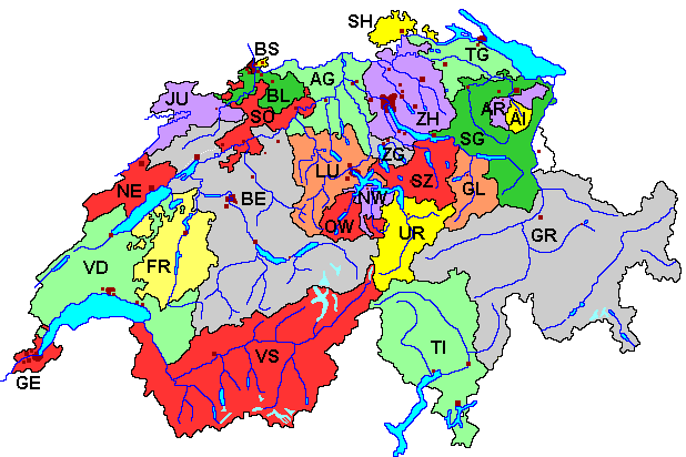
| AG | Aargau |
| AI | Appenzell Innerrhoden |
| AR | Appenzell Ausserrhoden |
| BE | Bern |
| BL | Basel-Land |
| BS | Basel-Stadt |
| FR | Fribourg / Freiburg |
| GE | Genève / Genf |
| GL | Glarus |
| GR | Grischuns / Graubünden |
| JU | Jura |
| LU | Luzern |
| NE | Neuchâtel / Neuenburg |
| NW | Nidwalden |
| OW | Obwalden |
| SG | St. Gallen |
| SH | Schaffhausen |
| SO | Solothurn |
| SZ | Schwyz |
| TG | Thurgau |
| TI | Ticino / Tessin |
| UR | Uri |
| VD | Vaud / Waadt |
| VS | Wallis |
| ZG | Zug |
| ZH | Zürich |
Links
| Swissmap | Official Swiss map with hiking trails. The best map. |
| Swissmap Mobile | Official Swiss map with hiking trails for mobile devices. GPS positioning is provided. A 10x10 km map can be downloaded for the offline usage. |
| Swiss hikes | Swiss map with hiking trails (Swisstopo) |
| Swisstopo Maps | Swisstopo without hiking layer (map.geo.admin.ch): best maps |
| Swisstopo | Federal Office of Topography swisstopo |
| Wandersite | Hiking and trekking in Switzerland |
| Switzerland Mobility | Hiking in Switzerland: maps and much more |
| My Switzerland | Tourism in Switzerland |
| Hikr | Hike reports |
| Sentiero | Links to hiking pages |
| GPS Tracks | GPS Tracks |
| Swisstopo API | Programming interface API for www.geo.admin.ch |